-

"hibiscustour", three separate sites -
Islands and lagoons New Caledonia, Polynesia (part). -

Curiosity. Things, amazing, science, society.. -

Ideas perso. Household, Practical life, D.I.Y, Computering..
 
but reality |
  |
|
- Four entities make up it: Australasia (*), Micronesia, Melanesia and Polynesia.
|
(*) And in fact, Oceania continent consists mainly of water, which is enough surprising !! Europe is also a case, on the one hand because it is necessary to cross the sea to go to England, but also because one can go without this gap to Peking and well beyond on the "Asian continent", welded in the continent "Europe well" One can still meditate on the concept of continent. In fact, Europe is a religious Christian continent and not a physical one. |
|
Note the fire maintained on board of the double hull boat.
|
|
Australia, Tasmania and New Guinea were joined together and the channels of sea towards Asia narrower. The displacement of the populations of Asia was thus carried out first of all towards these zones, Malaysia included, but there were no more possibilities beyond. The first traces of agriculture go back to -8000 years ; at this time, groups are well established there.
|
There is 4000 years a new wave, the "Austronésiens", from Formosa and Ma laysia, more evolved and holders of the pottery "Lapita", discovered in New Caledonia, are at the origin of
the Polynésien settlement , which is completed at the beginning of our era, after a thousand years interruption.
The boats with two hulls (enormous trunks) joined together by a wooden deck could reach 30 meters length and carry 100 men.
|
Pacific : Tahitipress, 27/08/2004 Vanuatu: archaeologists discover bodies going back to 3000 years, revealing the secrecies of the first men who colonized the Southern Pacific, indicated, Friday at AFP, researchers Australian.
|
Magazine "GEO" No 287 January 2003 : The ancestors of the Polynesians, Pascuans and Maoris of New Zealand, remarkable navigators, indeed
carried out a single exploit in the histoiry of humanity; the systematic colonization of the largest ocean of the world, the Pacific, 20 000 km from Asia to
central America, ocean become a regular place of exchange !
Far from rudimentary, their deep-sea dugouts with double hull being able to reach 60 meters. The They sailed without instruments, without sea maps, while following the avei'a, the way of the stars, which were used as reference marks, with the moon, the sun, the winds, as well as the direction of the swell, the colors, the luminosities near the grounds, the vegetable remains, the birds which still allow to appreciate distances from the island or grounds, according to their species (ex : the frigates fly more away than other species. |
This colonization does not owe anything to random because the islands are so small they have no chance chance to cross these little scattered dots on the sea ; as they were
probably without resources nor sufficient vegetation at that time, they would have died there from hunger if they did not brought what to survive with.
|
|
Curious : at the time of a "festival", the men of the Asmat tribe, in Irian Jaya (Western Guinea News), danced by making these movements of chisel with their legs, specific to the Polynesians (report TV Ushuaïa of the 27 12 2000). Food : The concern of the first navigators was well food : it would have been limited to the coconuts (Asia), which provided water and could be trailed in the water for two months, the fish (eaten raw or dried).. and perhaps also to the rats. Time passing the sedentarisation occure and came also the fruits of the breadfruit tree (Indo-Malaysia or the Pacific), the sugar cane, yam and tarot (Asia), the manioc, the banana tree (India), then the sweet potato (America); as for meat, the small black pig (Asia) which one still sees, the chicken (Asia) and also some good pieces of men, who could be appreciated in period of food shortage, for religious sacrifices, or for a big "party". Were the sacrificed people enemies, contenders, opponents, condemned man ??
|
In the western part (Melanesia), no common language was developed, but the Polynesian incursions had there some influence (language, modification of the dugouts). (*) Another assumption, which led to the successful navigation of Kon Tiki (raft), supports that these people, at least those of the Eastern Pacific, come from America; for some, they would be descendants of Olmèques driven out by the Mayas, which would have crossed the Ocean on basalt rafts.
|

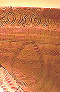
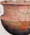
Lapita, name of the first discovery site in New Caledonia. Lapita pottery, museum of Nouméa - In less than 300 years of existence, pottery and ceramics "Lapita" have left to us these works adorned with fine carvings. |
 Over 300 sites spaced each others up to km 4500, shelter them.
They trace the moving of the Austronesian people in the South Pacific about 3000 years ago.
It would be one of the first expression of the Polynesian culture.
These pots were later abandonned, dethroned by the big stone ovens..
(note hibis : numerous techniques - and civilizations - have vanished for lack of "buyers".
It is a fact of life, which has been occured continuously without being noticed.
|
|
|
Is it thus so disconcerting that individuals with the fair hair (and some blue eyes) were announced by Alvero Mendana? (one found, into tombs of the Marquesas, in Fatu Hiva, light
brown hair, whereas the dyeing or discolouration was not practised).
There are blue eyes in Maré and Lifou and elsewhere (New Caledonia), but there, it is known that there were English missionaries...
France rules the Islands of the Société, the Australes (Southern), the Marchionesses, New Caledonia (of which Chesterfields located at 400 km towards Australia), Wallis and Futuna. For memory, France shared the administration of New Hebrides with England (condominion) before the independence of these islands called now Vanuatu. |
Petroglyphs
|
|
Petroglyphs remain a mystery because one cannot date them. They are widespread in all Oceania. In the same way remain unexplained the tumulus (ex: Island of the Pines). |
See also : "Cook - Bougainville - d'Entrecasteaux - Dumont d' Urville - La Pérouse", in
"WORDS".
Thanks to its influence on part of Oceania, France is the second underwater power after the USA and before England.
|
TAKING POSSESSION Tahiti : In 1834, French catholic missionnaires yet installed in Gambiers islands, settle in PAPEETE where the English Protestant pastors have been installed for 12 years, of which George Pritchard. The latter make pressure on the queen Aïmata Pomaré IV: French is obliged to re-embark. To wash this affront, one sends the captain A. Dupetit-Thouars (under Louis Philippe), to request repair from the queen (August 1838). A fight of influence follows and the disorder settles. The assembly of the tahitiens Chiefs claims French protectorate then to restore the peace. A provisional government is established in agreement with English but Pritchard does not disarm and hold again influence on Pomaré. In 1844, A. Dupetit-Thouars makes him expelled but England requires repair on his turn ! One speaks about war. but later, Pritchard is compensated and France keeps the protectorate. In Tahiti however, it is the effervescence and the revolt (1844 to 1846). It is again necessary to fight and the last rebels make allegeance on January 1, 1887. The Pomaré queen is faithful to France and dies after 50 years of reign (1887) by giving up her rights to France. (Larousse Encyclopaedia) NOTICE (for the choice of France, some speak about a "romance". |
TAKING POSSESSION New Caledonia : In 1843, the government (Louis Philippe) plans to take possession of New Caledonia. The French flag is planted in Balade from 1843 to 1846. At that time the Guizot minister has big difficulties with England (see on the right hand) and command to withdraw it to avoid new incident. is One interested again in New Caledonia under the second Republic and on their own side English activates and projects the installation of a deposit of coal. In 1853, the French imperial government is concerned with finding a ground to establish a penal settlement there. Napoleon III then orders the taking possession and on September 24, 1853, the admiral Auguste Febvrier-Despointes again makes hoist the French flag at Balade, then the 29, on the Pines island. Undoubtedly one benefits from the alliance England is searching with France in the Mediterranean sea. Australia, it, does not appreciate this change. A few days later, coming from China, Tardy de Montravel confirms the taking possession on the East coast then search a more secure port, finds a favourable one he call Port of France. (renamed later on Nouméa to avoid confusion with Fort de France). The first years, autochtones rebel starting from Hienghène and the conflict extends because it was necessary to delimit the canaques grounds and those allotted to the colonists. In 1878 a true insurrection under the control of the Ataï Chief bursts when the colonists bring their herds. Seven months after and 200 dead French and thousand kanak, Ataï is killed by Segou, Chief of Canala. Calms is restored in January 1879. (Guide Hachette). From 1864 to 1897, 22.000 condemned are received in different bagnes. Some profited later from concessions of grounds. |

|