-

"hibiscustour", three separate sites -

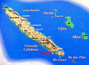
Islands and lagoons New Caledonia, Polynesia (part). -

Curiosity. Things, amazing, science, society.. -

Ideas perso. Household, Practical life, D.I.Y, Computering..
but reality |
  |
|
|

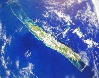
Photo Wikipedia. You will find another with the sea area from an official book.
|
 New Caledonia sea possession, said "sea of coral".
|
corals of the reef |
|
postcard |
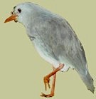 Here is our cagou, a bit less arrogant, but more natural.
The cagou is a curious bird which does not fly and which barks as a little dog. Endangered specie, it was victim of rats and one says dogs. It is protected and one can see it at the botanical and zoological park of Noumea. |
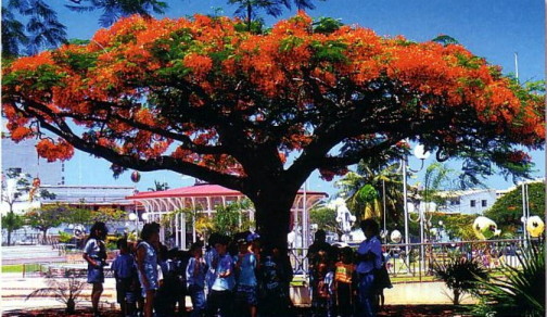 the flame trees in flowers herald the coming of the summer (Décember) |
|
|
|
|
|
Two summits culminate in North and the south, the Panié mount (1629 m) and the mount Humboldt (1618 m); this last is on the level of the international airport of Tontouta.
|
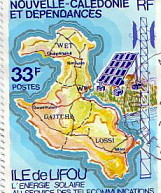
This "Pays d'Outre-mer" (overseas country), french collectivity, is divided into three "Provinces", including one for the easthern islands (Ouvéa, Tiga, Lifou and
Maré). A High commissioner represents the French government.
From the plane, "the pebble" shows its superb lagoon, but also its immense yellow-reddish scars due to the exploitation in open sky of the nickel discovered by Garnier. The lagoon is fantastic but the mountains, dry and bushy on the western side, refrain your enthusiasm because you do not see the expected " tropical paradise ". fortunately, it will be better once on the ground because all is to be discovered. Noumea
Nouméa: near the "rocher à la voile" (rock at the sail). |
Kanak songs.They are intimately linked to nature, dreams and the spirits of ancestors. According to tradition, the songs "aé-aé"
have their origin in water from a stream flowing over a rock. By breaking the stone, these songs are released.
They recount the history of the villages, the relationship between tribes and colonial repression.
Flutes and reed bamboo leaf packs, accompany dances
EASTERN COAST Valley The tribes are
numerous there, cultivating yams, tarots and manioc for
their roots, as well as the coffee. I was told that the best coffee, the "Leroy", is being planted again after ages
of abandon, but only for a an "elite".
WESTERN COAST Today perfumes and
liquors of niaouli are provided, if one
likes.
LARGE LAND "the pebble"
![]() Top of hut of Canala
Top of hut of Canala
rainy and very " tropical " with its beaches of white sand,
coconuts and banana trees; it is primarily a kanak land. The
rivers are short, straight and can become violent, of which
Tchamba and its broad mouth. The last "bac" (small formerly
hand powered ferry!) which currently remains makes it
possible to cross the magnificent
Ouaïème.
This one was formerly a source of income (the production is 50 tonnes/an, that is to say 1/5me consumption; the
remainder is imported mainly of New Guinea. The coprah,which was exported formerly, came especially from the
islands.
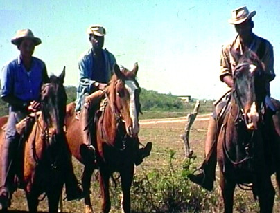
The extensive breeding
is practised there: it is the real of the " stockmen"
(inspired by Australia), especially in the area of Bourail
and La Foa (exhibitions of rodeos).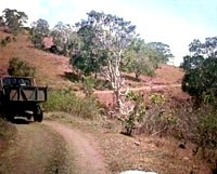
Typical summer landscape of the large farms
of the West coast. Undulating ground where the niaoulis
reign as masters. One formerly extracted the "goménol
spirit and oil".
THE NORTH
North east Caledonia :
in the background, the Panier mount
(1629 m).
THE SOUTH
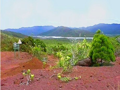 Wild spaces in the south of Nouméa, in direction to Prony and to the
Yaté dam. There is earth iron chromium is everywhere.
Its chemical exploitation is in hand because it also contains nickel. One can find unusual
plants there, like the carnivarous nepenthe, white orchids, and
even prehistoric prized wood.
Wild spaces in the south of Nouméa, in direction to Prony and to the
Yaté dam. There is earth iron chromium is everywhere.
Its chemical exploitation is in hand because it also contains nickel. One can find unusual
plants there, like the carnivarous nepenthe, white orchids, and
even prehistoric prized wood.
Beautiful picture from "Terre Sauvages",
special ecological edition about overseas French countries.
Kanak songs.
They are intimately linked to nature, dreams and
the spirits of ancestors. According to tradition, the songs
"aé-aé"
have their origin in water from a stream
flowing over a rock. By breaking the stone, these songs are released. They
recount the history of the villages, the relationship between tribes and
colonial repression. Flutes and reed bamboo leaf packs, accompany dances
pilou pilou.
According to the book
"voix des rivages et des montagnes"
par Françoise Degeorges.("Voices
of the shores and mountains" by Francoise Degeorges).
The country offers many "aquatic" opportunities, sailing around, fishing, diving, windsurfing, fly or kite or surf. The traditional surf is practiced only in a few spots. If you do not have a boat, try the turtle bay in Bourail. By boat, you can reach Gouaro (near Bourail) or in the pass of the Dumbea, some 25 km facing Noumea.
|
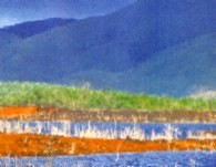
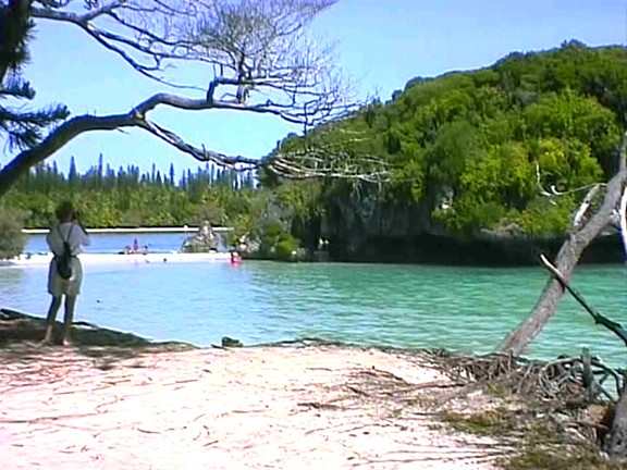
The LAGOON.
On the West coast, it is close to Nouméa,
where one can admire the second most beautiful lagoon of the world, wich circle 1600 km length..for a surface
of 22,000 square km.
The reef rank second after the Great Australian Barrier. Its marvellous colors emerald, or are due to sand at a shallow water deep, lighted by the tropical sun. |
Bird view with the reef and its passe (original color exces faded). 13% of the population owns a motorboat. |
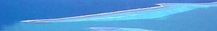
Up to 30 km from the West coast, 60 km to the South (île des Pins) and much more to the North, beyond the archipelago of Belep islands, the reef circle the
lagoon. It testify the ancient size of the main land. To the East, facing the trade wind, it is nearby the coast.
The lagoon of New Caledonia totalize 1600 Km length (circle) and a 22000 km2 square area (see satellite photo, at the top).
ISLANDS
Islands are exclusively dedicated to the tribes. They have a special place in the territory and their tribes watch closely to their land ancestral rights. So much that a public school can be subjected to the tribal law. The ground is inalienable and can be sold only to the residents. Three of the four large islands stems from coral ; they are called "îles Loyauté" (Loyalty islands) and are located east of the mainland. Their base consists of raised coral, a limestone solid mass often very hard, strewn with cavities and caves. Dead coral ; To dig in a dead coral atoll is not easy matter to achieve because the coral is very compact once collapsed down and packed. Small borings are often made with the crowbar. The ground thusd is not homogeneous; it is not rare to meet there excavations and even true caves. All the Society islands are like that. |
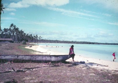 Photograph from 1968.
This setting is not arranged, and the natural grace of this young person, looking after her child playing in the water, is quite authentic.
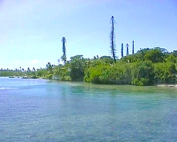
Pine Island (Île des Pins)
|

|


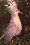 The cagou, emblem of New Caledonia

